I've spent a ton of time just wandering aimlessly through the woods in search of rocks to climb on. I like to pretend I know where I am going and that "Oh there is definitely going to be a mega zone just over this next hill I can practically taste it" but in reality I am just getting lost. Maybe I'm training my rock-sniffing sense, really locking in the long distance imaginary smell of granite blocks and the faint notes that differentiate the V15 Ultimate Dream Rig from the Vb lowball turd. "Wait! Stop! You smell that??? There's a perfect 45 nearby with just enough edges!!" "Dude can you hear that?? There's a righteous slab just around the corner I swear!!"
All jokes aside, those that develop or spend a ton of time meandering the forests in search of fresh blocks have probably joked to themselves something similar. Especially after cresting yet another hill to find a pile of two footers or mistaken those dead pines for a mega highball from a distance for the umpteenth time. However, when it all comes together and you really DO find something incredible, be it a highball, perfect crimp overhang or rowdy sloper compression rig: the feeling is nothing short of real magic. And once you find it, clean it and then finally climb it (hopefully not on the first try) the dopamine dump is pure elation. It’s what keeps us scrubbers going and fuels us to return to the unknown time and time again.

Sometimes it feels like scouring the woods is a lost cause and that you really are just wasting your time. Maybe you should finally go back to the developed, popular zones and actually send your five year project. What if there was an easier way? Someone who could just tell you "Here's your gps pin for an undeveloped zone with 400 boulder problems on perfect rock waiting to be done." An honest rock fairy that just points you in the right direction.
A couple months ago a friend of mine started using a program called LIDAR. Basically it’s a satellite laser scan of the ground that beams back a map of every single rock and cliff in great detail. It even gives you an approximate height based on color so you know if it’s a cliff or boulder. Perfect! Finding new boulders and cliffs should be a piece of cake! It’s pretty much then wish of a rock fairy come true! While this is really sweet technology and completely changes the game of finding new rocks in the woods to play on, I simultaneously really enjoy it and strongly dislike it.
The enjoyment portion is obvious; find an area of public access land with a concentration of orange dots on the map and hike directly to it. Boom! Now finding a new area only takes an outing or two. However on the other side of the coin I think it’s essentially cheating. It’s cheating in the sense that you no longer have to struggle through thick woods like climbers have before for decades and also cheating yourself of the wonderful surprise of stumbling into a new zone. It’s almost like if your buddy in high school had the answer sheet to all the homework and tests. Sure you could just take the sheet and ace everything but in the long run you are cheating yourself of any education or life experience you would have to go through to get a good grade the real way. Using LIDAR is very similar to cheating; although there’s no grade you receive you alter the experience. Sure you can just look at a state park near you, find some orange dots (which indicate rocky outcroppings, boulders and short cliffs) and pretty much be guaranteed to find something to climb on, but that takes the unknown element out of it.
For me half of the point of wandering the woods is the adventure aspect. Going for a walk and not knowing if today will be another day where you strike out and find nothing or if it will be the day where you hit an absolute jackpot. A goldmine that will keep you busy for years and occupy a large portion of your thoughts and motivation. Running through the trees and paying attention to rises and dips in the land, trying to follow ridgelines, small rock piles, and exposed bedrock to hopefully find something worthy. Simultaneously, when you are bushwhacking around you are developing your sense of direction and ability to navigate and not get lost, which is an important skill that I believe, is starting to fade with the new generation of gym-goers heading outside that are completely reliant on GPS pins. While This LIDAR completely removes the potential for an experience like that where you would otherwise be absolutely mind blown because it creates an expectation that wouldn’t have been there otherwise.

Admittedly I have relied on Google Earth—especially in my earlier days of exploring—to be a crucial tool. The numerous pins I have saved on there have led to some successes but also a good amount of failure. You can’t see where property lines are on Google Earth, so you might get out there and be stopped prematurely by several no trespassing signs. It’s also pretty hard to tell how big something actually is on Google Earth, as it could just be a flat rock outcropping or exposed piece of granite. In addition there are also usually 70 foot trees blocking view of any boulders, at least here in the Northeast. If you take a look at Boulder Natural at Pawtuckaway State Park for example, you will just see the tops of trees and you would not typically guess that there is dozens of massive boulders sitting under the canopy. LIDAR breaks through the treetops and scans the ground underneath. Don’t get me wrong, going to check out a pile of rocks found on Google Earth or LIDAR is still quite exciting but the journey is tainted with the knowledge that there is at least something out in those woods. In addition, if you use these satellite technologies, chances are that you’re plugging in a GPS pin into your phone and making a beeline to the pin. The destination has already been set before the journey even begins.
These days a lot of my explorations are either very spontaneous or exploring the surroundings of already existing areas. I might stop at a trailhead that I drive by and run around for an hour and see if I find anything. Considering I live in the Granite State there’s usually some rock outcroppings or small boulders but mostly nothing truly worth my time. Even if I do find a decent boulder, that probably still isn’t worth going back for a 30 minute hike just to do three problems under v4. I am also lucky in that I have friends who keep finding or know of undeveloped areas and I get invited out to develop. This is like a different kind of development cheat code: “friends in the know.” So I haven’t even felt the need as much to find something myself when I already know of five areas that each have hundreds of problems waiting to be done. I essentially have way too much to develop and not enough time, which is a great problem to have! Even despite this, I still enjoy trying to hunt for fresh areas just because it’s fun.
One particular memory I have of hunting for a boulder was at a local spot near me called Clough State Park. I was solo wandering as usual and decided to see if there was anything in the woods past a new zone called the Lone Wolf area that I had been working on. So the quest began. Not even 5 minutes after leaving the Lone Wolf area I came across a nice small boulder which became the Moonstone and saw several boulders littered across the hill to my right. I was stoked but not completely enamored so I kept pushing on. What happened next is a feeling that I've continued to chase since then. I started walking up a faint hill and over the crest I could see quite a pile of boulders. I was very excited and began to run. As I approached I noticed just beyond the boulder pile a massive arete that belonged to a huge boulder. I could not believe it. I said "WHAT" to myself aloud. I sprinted to the boulder in awe of what I had found. How could something like this exist? How could I as new climber find something like this? There's rocks this big chilling in the woods that aren't listed on Mountain Project?
This massive rock became known as The Colossus. I didn't end up climbing it until around six years later when I had finally figured out the alien technology that some people call ropes. I call them tangle-prone pains. With that new knowledge and much more experience at high balls I was able to clean, rehearse and climb the first ascent of The Colossus. While it was a pretty easy climb (no harder than v1 but with the crux at the top) it was a beautiful coming-full-circle moment. I found it by myself and eventually climbed it by myself, with no one but the trees as my witness... and of course my cellphone on a tripod because as we all know, footy or it didn't happen. Since then I have gone back and established a harrowing direct exit to The Colossus, two lines to the left, and a link up. All of which area amazing highballs that would be great top rope lines for those with less experience above the no fall zone.

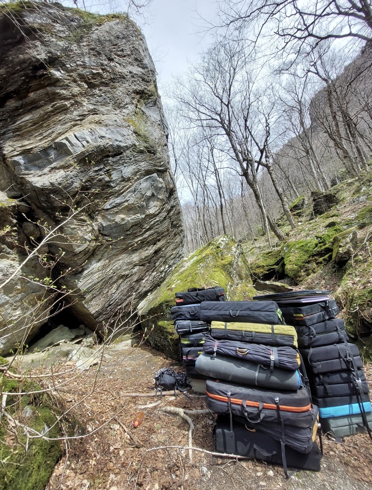
Now I wonder how that experience would have been different had I found The Colossus on LIDAR first and known that there was a 30 foot boulder and rock stack out there. I imagine that the absolute wonder I had when I initially found it would have been greatly subdued. That feeling is something I have chased like a dragon in the years since. There is something special about finding a new spot all by oneself, solo, questing through the trees. I recently had an experience where I found something that I would consider a total jackpot! The boulder lottery! I cannot wait to haul pads two hours into the woods to claw my phalanges up those rigs that have been stuck in my head all winter. When I find an area with problems that good waiting to be climbed I definitely get obsessed. Maybe I'll report back on how that all goes in a future update.

A nice boulder in a new zone a buddy of mine found through scouring Google Earth. Those satellite maps sure are helpful, but imagine the feeling of finding a 100+ problem area on good rock from merely wandering around. If you had absolutely no idea if there was going to be rock and then bushwhacking over a hillside into a valley full of boulders! Regardless, I’m still super stoked on this area!
So what is the takeaway in all of this aimless dribble I've spewed into words for you all to read? Well whether or not you use Google Earth, Lidar, Topo Maps, Friends in the Know, or your supposed rock-sensitive nose to find new things to climb doesn't really matter to me. I hope that whatever your method is, you treat it like an adventure and really try to enjoy the process from start to finish! Run around like a forest critter and find only 4 foot boulders! Tramp around until you find THE rig! Go out in the woods and get lost (without actually getting lost- tell someone where you are going). You can't be found if you don't get lost, and who knows, maybe you'll find yourself AND something to climb on.
Find Jacob on instagram @itsperryyy
Subscribe to our newsletter